Contents of this page may be automatically translated, we take no responsibility for the accuracy of the translation. Feel free to contact our customer support centre if you have any questions.

The distance to a satellite is determined in code measurement by measuring how long time it takes for the satellite signal to reach the receiver. Code measurement is the simplest form of GNSS measurement and is used in e.g. mobile phones and simple navigation equipment.
The principle of code measurement
When measuring code, the GNSS receiver calculates the distance between the receiver and the satellite as the speed of light multiplied by the time it takes for the signal to travel between the satellite and the receiver.
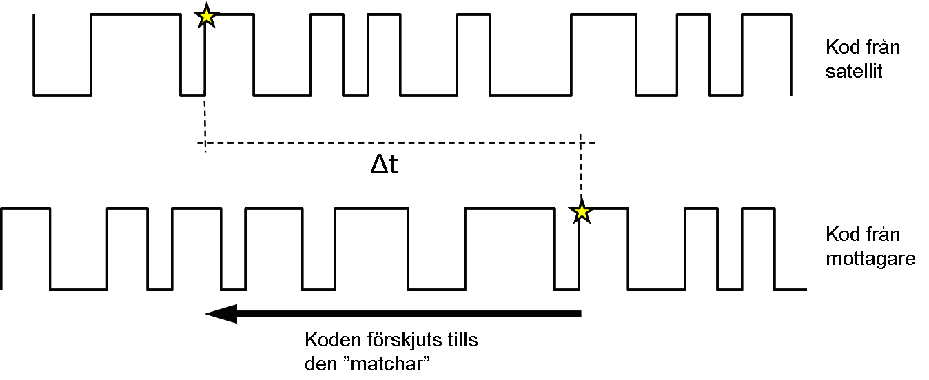
The time between sending and receiving the GNSS signal is relatively easy to determine. The satellites and GNSS receivers are intended to generate the same code at the same time. By shifting the local code in the receiver until it matches the received code, a time difference is obtained.
By measuring against three satellites at the same time, you can in principle determine the position of the GNSS receiver in three dimensions (X,Y,Z). However, since the GNSS receiver's clock is relatively uncertain, you also need to determine the uncertainty of the receiver clock. This means that to calculate a position, measurements must be made against four satellites to determine the four unknown parameters (X, Y, Z and the receiver's clock error).

How accurate is GNSS distance measurement?
A useful rule of thumb is that the signal resolution is about one percent of the wavelength, which is true for both code and carrier phase. Below that limit, the receiver cannot reliably match the signal copies. As an example, we can take the so-called C/A code of the L1 frequency of GPS satellites. The C/A code has a chip length of about 300 metres and the signal resolution – or "accuracy" – in measuring the distance to a satellite is therefore about three meters in code measurement.

