Contents of this page may be automatically translated, we take no responsibility for the accuracy of the translation. Feel free to contact our customer support centre if you have any questions.

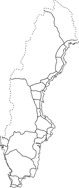
The Swedish height system 1900, RH 00, is based on the first precise levelling of Sweden which was carried out during the period 1886–1905.
The use of RH 00
In national contexts, RH 00 has lhad its day. At the local and regional level, before the launch of RH 2000, there were many applications where RH 00 was used. Many local height networks were connected to RH 00. As the coverage and quality of the first precise levelling was poor and as later densifications were of even poorer quality, the connection points were often inadequate. This has led to a lot of local RH 00 networks with very poor connection to each other and often poor internal geometry. Among other things, in connection with the introduction of new measurement technology (GNSS), these shortcomings became an increasing problem. Today, most local users have left RH 00 and adopted RH 2000.
The first precise levelling
On the ground, RH 00 was represented by approximately 2,500 benchmarks from the first precise levelling.

To cover the need for the general mapping, the precision line network has over the years been densified in several steps with a large number of points in the so-called line levelling. The line levelling is described in History – height systems (pdf, in Swedish, new window).
The mean sea level in Stockholm in the year 1900 was chosen as the zero level, represented by a marked point on Riddarholmen in central Stockholm.
No account was taken to the land uplift when calculating RH 00. Therefore, the heights in RH 00 cannot be related to any common time (epoch), but apart from the northernmost part, 1892 can be considered an approximate epoch.
System facts
- Vertical datum point point: Riddarholmen, Stockholm
- Reference epoch: Approximately 1892
- Type of heights: Orthometric heights
- Standard error: 4.4 mm / √km
- Corrections: No land uplift or earth tide correction

